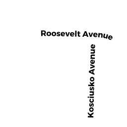
LT 161 NEW YORK AV
Owner Information
DRAGHETTI STEVEN G
26 INDEPENDENCE RD
FEEDING HILLS, MA 01030


Property Details
LT 161 NEW YORK AV is classified as a Undevelopable Residential Land.
The primary structure on this property was built in 1799.
LT 161 NEW YORK AV is valued at $1,700. The land is valued at $1,700 and the structures are valued at $0.
This property is in Zone AG. Confirm with local Zoning Board authorities to ensure there are no overlays or other easements on this property.
The most recent deed for LT 161 NEW YORK AV is recorded at the local registrar in Book 20891, Page 341. LT 161 NEW YORK AV was last sold on Wednesday, September 30, 2015 for $7,500.
Assessment data from fiscal year 2022.
Flood Data
According to the FEMA National Flood Hazard Layer, this property does not appear to be in a flood zone. It may also be in an area not yet reviewed. Nonetheless, confirm this information prior to taking any action.
To view the flood hazards around this property, create a FEMA "Firmette" Map of the area around LT 161 NEW YORK AV.
Broadband Internet Providers
| Provider | Type | Bandwidth (mbps) | |
|---|---|---|---|
| GCI Communication Corp. | Satellite | 0 | 0 |
| Crown Castle Fiber | Fiber | 0 | 0 |
| Viasat Inc | Satellite | 35 | 3 |
| Verizon New England Inc. | DSL | 5 | 0 |
| Comcast | Cable | 1000 | 35 |
| T-Mobile | Fixed Wireless | 25 | 3 |
| VSAT Systems, LLC. | Satellite | 2 | 1 |
| HughesNet | Satellite | 25 | 3 |
Broadband service provider data from December 2020.